Geology and Landforms
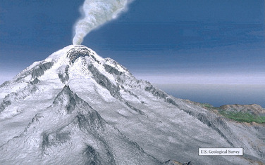
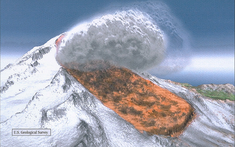
Mount Rainier is the most iconic landform of this national park, especially because the area was named after the peak. It was formed more than half a million years ago, due to a base built by the lava of other volcanoes. Then, when lava and ash emerged from the newly created Mount Rainier, it filled the nearby canyons and built a summit over time. This summit is approximately 16,000 feet high. When Mount Rainier was just being born, is was formed by layers of lava and loose rock, but this had the possibility of transforming into hydrothermally altered rock. This type of rock is unstable and causes a risk for landslides and lahars, as you can witness in the image below.
|
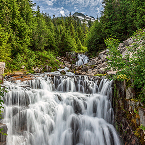
The majority of the glacier landforms on Mount Rainier are an effect of the Pleistocene glaciers 25,000 to 10,000 years ago too. They still are existing today, and continue to erode Mount Rainier. The 25 major ones create the largest collection of permanent ice on a single peak south of Alaska. The glaciers carved most of the valleys in the surrounding areas of the volcano and some other mountains as well. Other landforms that are in Mount Rainier National Park are the famous wildflowers, cedar and hemlock forests, glacier moraines (masses of rock that get carried down and deposited by a glacier), and waterfalls. Two examples of these creations are Christine Falls and Comet Falls.
|
|